

Description
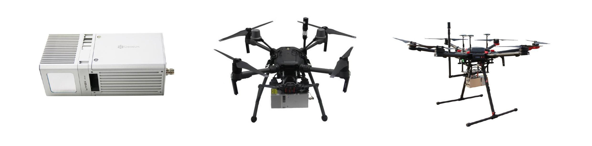
Geosun gAirHawk LiDAR GS-MID40 is a kind of light compact LiDAR point cloud data acquisition system, integrated DJI laser scanner, GNSSand IMU positioning and attitude determination system, and storage control unit, is able to real-time, dynamically,massively collect high precision point cloud data and rich image information. It is widely used in the acquisition of 3Dspatial information in surveying, electricity, forestry, agriculture, land planning.
Product Superiority
Low cost
With the help of DJI laser sensors, a laser scanning system of thousands USD has been realized
High efficiency
Stand-alone daily survey 2 square kilometers
High integration
Point cloud data time synchronization
Point cloud data / POS data unified storage
Simultaneous acquisition of image data
System stability
Safe operating time over 8000 hours
Easy to operate
Supports one-button process data collection, one-click take-off and landing, automatically execute flight route.
Real-time monitoring
Support point cloud data, POS parameters, and real-time display device status during operation.
Specification Geosun gAirHawk LiDAR GS-MID40
GS-MID40 Parameters
- Weight: 1.2kg (without camera)
- Measuring accuracy: 15 cm
- Power range: 12V~16V
- Working temperature: -20℃~+55℃
- Consumption: Average 20W
- Support Platform: DJI M210, DJI M600 PRO
- Storage: 64 GB storage, maximum support 128GB TF card
Lidar Unit
- Measuring Range: 90m@10% Reflectivity, 130m@20% Reflectivity
- Laser class: 905nm Class1 (IEC 60825-1:2014)
- Max. range: 260 m
- Mix. range: 0.3 M
- Range accuracy: Less than 2 cm
- Data: Double echo, 200,000 Points/Sec
- FOV: 38.4° the circular view
POS Unit
- Update frequency: 200HZ
- Heading accuracy: 0.08°
- Pitch accuracy: 0.03°
- Rolling accuracy: 0.03°
- Position accuracy: ≤0.05m
- GNSS signal type: GPSL1/L2 GLONASSL1/L2 BDS B1/B2a/B3
Pre-processing software
- POS software: Output information: position, speed, attitude
- Point cloud software: Output point cloud data format: LAS format, custom TXT format
Camera (option)
- Camera Model: Sony a 6000
- Effective Pixel: 24 Mega Pixel
- Trigger event: Distance or Time trigger
- Weight (g): Less than 600
Package Includes:
- GS-MID40 UAV LiDAR scanning system (POS Unit & Livox Avia Laser)
- Power Connection Cable
- GNSS Aerial Antenna
- GNSS Cable Connected LiDAR scanning system and Antenna
- MICRO SD Card 128 GB
- MICRO SD Card 8 GB
- High precision GNSS positioning & orientation post-processing
- Software (Shuttle software)
- LiDAR scanning system processing software (gAirhawk software)
- Carry case
- USB Drive
gAirHawk GS-MID40 UAV LIDAR SCANNING SYSTEM >>>> Spec sheet (PDF)
Reviews
There are no reviews yet.