
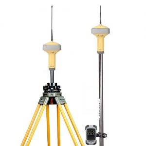
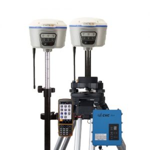
Description
GPS Geodetik CHC X900 adalah salah satu penerima GNSS RTK yang memanfaatkan teknologi GNSS terbaru dengan mengintegrasikan 120 saluran dengan kemampuan untuk melacak GPS, GLONASS, Galileo dan Beidou dan perangkat lunak lapangan yang didedikasikan untuk survei topografi dan konstruksi.
Fitur CHC X900 GNSS RTK
- 120 saluran GNSS inti dengan kemampuan untuk melacak GPS, GLONASS, Galileo dan BeiDou.
- Pemosisian GNSS RTK kinerja tinggi yang mencakup berbagai aplikasi.
- Skala perangkat lunak pengumpulan data Lapangan SurvCE Landstar atau Carlson untuk kebutuhan survei Anda.
- Bluetooth, GPRS, dan modem radio terintegrasi.
- Desain inovatif dan kokoh yang dibuat untuk lingkungan yang keras.
Spesifikasi GPS Geodetik CHC X900
| GNSS characteristics | Physical | |||
| 120channel signal tracking | Size (HxD): 84 x 179 mm (3.3 x 7.0 in) | |||
| GPS: L1, L2, L2C, L5 | Weight: 1.4 kg with battery (49 oz) | |||
| GLONASS: L1, L2 | Operating temperature: 40 °C to +65 °C (40°F to 149°F) | |||
| SBAS: WAAS, EGNOS, MSAS | Storage temperature: 40 °C to +75°C (40°F to 167°F) | |||
| BeiDou: B1, B2 | Humidity: 100% condensation | |||
| Galileo: E1, E5A, E5B (optional) | Waterproof and dust proof: IP67 protected from temporary | |||
| Advanced multipath mitigation technology | immersion to depth of 1 meter, floats | |||
| Low noise carrier phase measurement | Shock: survives a 2meter drop on to concrete | |||
| Performance specifications | Electrical | |||
| Real Time Kinematics (RTK) | Power consumption: 2.6 W | |||
| – Horizontal: 10 mm + 1 ppm RMS | Liion battery capacity: 2200 mAh | |||
| – Vertical: 20 mm + 1 ppm RMS | Battery life: typical 5 hours in RTK mode | |||
| – Initialization time: < 10 s | External power input: 918 VDC | |||
| – Initialization reliability: > 99.9% | ||||
| Post Processing Static | Software (optional) | |||
| – Horizontal: 5 mm + 1 ppm RMS | ||||
| – Vertical: 10 mm + 1 ppm RMS | CHC’s Landstar field data collection software | |||
| Carlson’s SurvCE field data collection software | ||||
| Communications | ||||
| 1x RS232 serial port | ||||
| 1x high speed USB | ||||
| Integrated Bluetooth® class 2 | ||||
| Integrated GSM/GPRS modem | ||||
| CHC radio modem internal Rx: 430450/450470 MHz | ||||
| Optional radio modem(2): | ||||
| – Internal Rx/Tx: 403473 MHz | ||||
| – External Tx DL5: 1W 20W adjustable | ||||
| Protocols: | ||||
| – RTCM2.1, RTCM2.3, RTCM3.0, CMR, CMR+ and RTCA | ||||
| – NMEA0183 output | ||||
| – RINEX and HCN outputs for GNSS raw data | ||||
| Data Storage: | ||||
| – 4 GB internal memory | ||||
| – GPS device mounts as a USB external hard drive. | ||||
GPS Geodetik CHC X900 GNSS RTK System >>>> Spec sheet (PDF)


Reviews
There are no reviews yet.